


Why are polders an important part of China’s water heritage
27 Feb 2023
As a civilisation originating from rivers, China possesses one of the world’s largest water resources and has a long history of water management. It is particularly the case in the Yangtze River Delta, where many rivers and lakes connect, requiring a huge amount of effort in their management.
One of the landscapes that resulted from water management is the polder. Known as weitian (圩田) in Chinese, polders are reclaimed wetlands enclosed with dykes to be hydrologically separated from the surrounding fluctuating water and then drained manually to become suitable for farming.
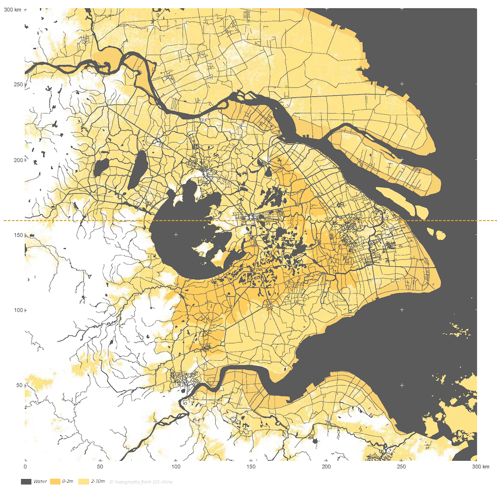 Map of the Yangtze River Delta, within which the Tai Lake Basin is characterised by low-lying lands. Source: Nolf et al., Delta Management in Evolution: A Comparative Review of the Yangtze River Delta and Rhine-Meuse- Scheldt Delta
In a paper recently published in Planning Perspectives, researchers from China, the UK and the Netherlands, advocate that polder landscapes in the basin of Tai Lake, the largest lake in the Yangtze River Delta, need to be considered as a manifestation of China’s water heritage ever since they first emerged in the fifth century BCE.
Dr Yiwen Wang, associate professor at Xi’an Jiaotong-Liverpool University (XJTLU)’s Department of Urban Planning and Design and the corresponding author of the paper, says:
“Polders in this area are some of the oldest landscapes on our planet that have been continuously managed by humans. They are the result of sustained human endeavour to shape the surrounding environment over generations.
“They reflect how Chinese politics, culture, and society have evolved, and represent traditional practices of agriculture and water management as well as socioeconomic systems of rural societies.”
The study examines how polders in the Tai Lake Basin evolved in China over the past 2,500 years and explains why they represent a type of ‘continuing landscape’, constantly evolving and reflecting the changing needs of our culture and society.
How polders developed over the centuries
The earliest attempt to build centralised large-scale polders began in the fifth century BCE in the Tai Lake Basin when the Wu State sought to control grain production and ensure military supply while in wars with its rival, the Yue State, according to Dr Wang.
“The practice was extended by the Tang Dynasty when more and more large-scale polders, known as dyked-canal polders or tangpu weitian (塘浦圩田), were constructed by the eighth century to feed the immigrants who fled from a military rebellion in the north,” she says.
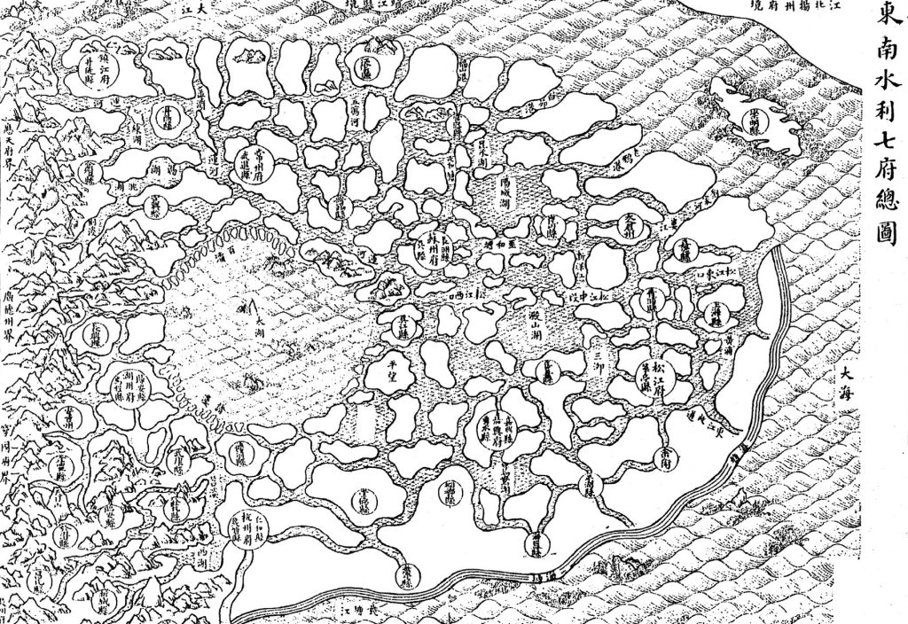 The water conservancy map of the Yangtze River Delta and the Tai Lake Basin. Source: the Map of Seven Prefectures of Southeast China, from Zhang, The Water Conservancy of the Wu District
However, in the following Song Dynasty, the centralised polder system was abolished and replaced by a land leasehold system.
“State-owned farmlands were leased out to local gentry, who then rented them again to tenant farmers. The privatised approach eventually led to the development of small-size creek polders, or jingbang weitian (泾浜圩田), which prevailed until the end of the Yuan Dynasty in the 14th century.
“The small polder system remained dominant during the Ming and Qing dynasties from the 14th to the 20th century. These small polders were known as lake polders or hudang weitian (湖荡圩田) as they were reclaimed from lakes or swamps. By the early 20th century, they were further compartmented into even smaller islet-like polders, dubbed as fish-scale polders or yulin wei (鱼鳞圩), for their shapes as seen on aerial photos,” Dr Wang says.
After that, the establishment of the People’s Republic of China in 1949 brought back the large-scale centralised polder system called united polders (lianwei, 联圩) or joint polders (bingwei, 并圩).
Dr Wang explains: “One of the reasons for the change was flood prevention. In 1954, a destructive flood in the Yangtze River showed that small polders were vulnerable to such natural disasters. The local government called for the merging of small polders or the construction of large ones to make these important agricultural landscapes much more resilient to floods while producing higher yield.”
Disappearing polders and water heritage
“After China’s economic reform in 1978, three factors threatened the polder landscapes that have existed for more than two millennia in the Tai Lake Basin – rural industrialisation, agricultural modernisation, and urban encroachment,” says Dr Wang.
“Farmers and villagers were encouraged to work in manufacturing plants and factories built on farmlands and within polders, and the organic forms of polders were replaced by standardised rectangular patterns for industrialised agricultural production.
“Moreover, accelerated urbanisation started to occupy more and more rural lands. Vast rural farming lands were converted into urban land use by local authorities for the sake of economic growth.”
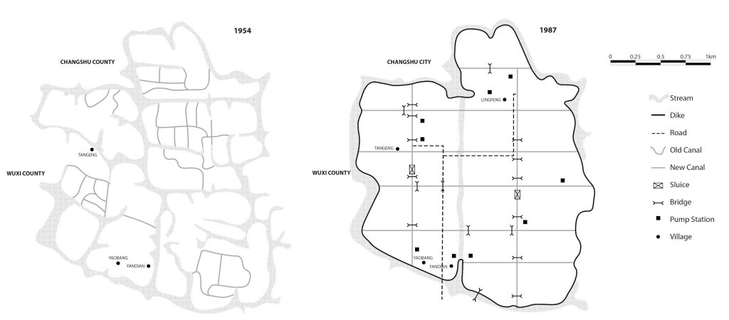 The layout of the Fandian Polder in Suzhou, respectively in 1954 and 1987. Source: adapted from Xie, Restructuring Cultural Landscapes in Metropolitan Areas, 103, Zhan et al., The local chronicles of Wu County, 400
Dr Wang explains: “According to statistics, built-up areas in the Tai Lake Basin increased from 10% to 24% from 1985 to 2015 due to the three previously mentioned factors. More recently, remaining polders continue disappearing as they are being demolished to make way for rural tourism and recreational development.
“The polder landscapes are very susceptible to development because the low-lying farmlands and waterways don’t have distinctive features that make them visible at eye level. Also, as a landscape that adapts and changes over time, they do not fit within our stereotype of ‘heritage’.
“However, satellite or drone imagery show that polders were, and still are, an integral part of the Tai Lake Basin.”
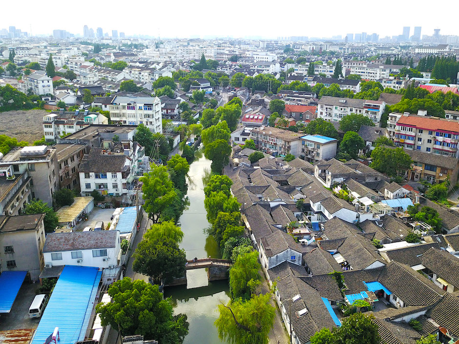
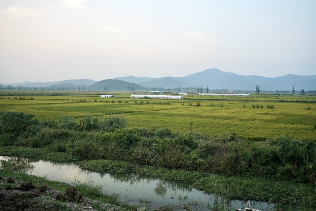 Polders in the Tai Lake Basin, 2022. Photo credit: Yi Qian
The researchers believe the polder landscapes are an important part of cultural heritage that should be protected from further loss, and that new interventions, farming methods, and irrigation systems should be integrated into the protection of these ‘continuing landscapes.’
“In this way, the polder landscape in the Tai Lake Basin would continue to display the vernacular past of China,” she says.
The study, The water heritage of China: the polders of Tai Lake Basin as continuing landscape, can be accessed online here.
By Yi Qian
Edited by Catherine Diamond and Patricia Pieterse
27 Feb 2023
RELATED NEWS
Researchers propose a more effective method to predict floods
More of us are vulnerable to the effects of flooding than ever before due to changes in climate, land use, infrastructure and population growth in recent dec...
Learn more

Digital transformation in construction industry requires more support, study shows
In recent years, the engineering and construction industries have been exploring the use of digital technologies to boost productivity and improve safety, qu...
Learn more
The city of Suzhou: Paradise on earth in eight frames
Known as “paradise on earth”, Suzhou has long been famous for its exquisite gardens and silk garments. Today, in addition to its rich history, it is one of t...
Learn more